Hiking Tom's Thumb Trail: McDowell Sonoran Preserve Guide
Embark on the iconic summit trek through the McDowell Sonoran Preserve, where rugged granite spires, sweeping desert vistas, and the famed Tom's Thumb Trailhead invite you to explore a 4‑mile round‑trip of steep climbs and rewarding views. This hiking Tom's Thumb Trail McDowell Sonoran Preserve guide delivers essential stats, trailhead amenities, dog‑friendly rules, and seasonal safety tips so you can conquer the summit with confidence.
Tom’s Thumb Trail – A Signature Summit Hike
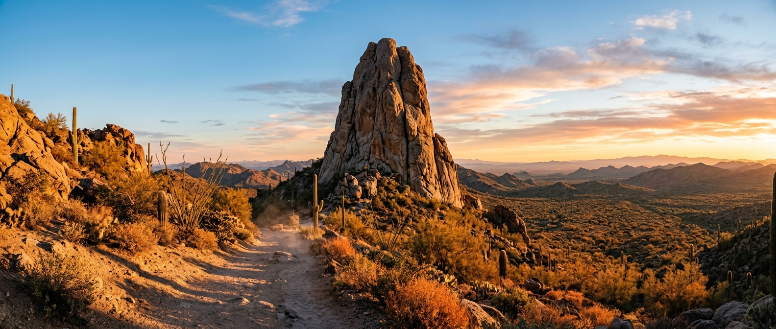
Perched at the edge of the McDowell Sonoran Preserve, Tom’s Thumb offers one of Arizona’s most rewarding urban‑adjacent climbs. The 140‑foot granite monolith was named for Tom Kreuser, an early climber who pioneered routes on the spire, and it crowns a summit that reaches 3,848 feet above sea level.
Most hikers complete the round‑trip in about 2–3 hours, covering roughly 4.0 miles and conquering an elevation gain of approximately 1,200 feet. The trail’s steep, loose‑gravel climbs reward the effort with sweeping views of the Phoenix metropolitan basin and the surrounding Sonoran desert landscape.
Because the trailhead—located at 23015 N 128th St, Scottsdale—provides only shaded ramadas and composting restrooms (no drinking water), a thorough preparation plan is essential. Bring at least one liter of water per hour, pack sun protection, and be ready for the “zero‑water” policy at the start point.
Dog owners will appreciate that the Tom’s Thumb Trail is dog‑friendly, provided pets remain on a physical leash no longer than six feet and are kept off the trail when temperatures exceed 100 °F, in accordance with McDowell Sonoran Preserve guidelines.
Whether you are tackling the main summit or exploring side spurs such as Ogre’s Den and Windgate Overlook, this hiking Tom’s Thumb Trail McDowell Sonoran Preserve guide equips you with the practical details you need to enjoy the iconic experience safely.
Explore more of the region’s scenic routes by checking the full list of mcdowell sonoran preserve trails, each offering a unique glimpse into the desert’s rugged beauty.
Specification
Details
Distance
4.0–4.25 mi round‑trip
Elevation Gain
approximately 1,025–1,200+ ft
Summit Elevation
3,848 ft above sea level
Hike Difficulty
Strenuous – very steep climbs
Route Type
Out‑and‑back with optional spur trails (e.g., Ogre’s Den, Windgate Overlook)
Duration
2–3 hours average completion time
Dog Regulations
Allowed on a physical leash ≤6 ft; prohibited when trail temperatures reach 100 °F (37.8 °C)
Trailhead Hours
Open sunrise to sunset daily
Admission
Free parking and entry
Tom's Thumb Trail Map and Elevation Gain Overview
Route Overview
Thishiking Tom's Thumb Trail McDowell Sonoran Preserve guidebegins at the paved pavilion located at 23015 N 128th St. The trailhead offers shaded ramadas, interpretive signs, and composting toilets, but there isno running water—so pack at least one liter per hour of hiking.
From Wash to Switchbacks
After a brief walk across a gentle desert wash, the path quickly steepens into a series of relentless switchbacks cut into decomposed granite. The loose gravel underfoot demands shoes with aggressive tread; without proper traction, the ascent can feel treacherous.
Saddle and Ridgeline
At roughly mile 1.3 you reach a short saddle where the gradient eases. From here the ridge narrows, guiding you toward the iconic granite spire known as Tom's Thumb. The final stretch follows a rugged ridgeline dotted with boulder gardens that resemble giant sculptures.
Key Statistics
Distance: about 4 miles round‑trip.
Elevation gain: approximately 1,200 ft (the trail’s climb is often cited as 1,217 ft).
Hike difficulty: moderate to strenuous due to steep grades and loose footing.
Practical Tips
Start early in the cooler months (November – April) to avoid high temperatures.
Carry at least 1 liter of water per hour; remember the trailhead has no water source.
Dogs are welcome on a handheld leash no longer than six feet, but they must be turned back when temperatures exceed 100°F (38°C).
Maintain a steady, controlled pace on the switchbacks; short, deliberate steps help preserve energy and protect your ankles on the loose granite.
Consider trekking poles for added stability on the steep sections and the final ridgeline.
The Switchbacks & Saddle: Steep Ascent & Rest
Switchback Segment Overview
Distance:about4 miles round‑trip
Elevation Gain:1,025–1,200 ftof steady climb
Terrain:steep granite steps that wind up the ridge
Highlight:a breezy saddle near the top, perfect for a short rest and panoramic views
More Info:trail map and details
Rest‑Point Summary
Elevation:2,450 ft •Distance:3.2 mi from trailhead •Parking:12 spots
Shaded ramada with bench seating
Interpretive sign highlighting local flora
Water refill station (seasonal)
Tom’s Thumb trail map
Safety Tips for the Switchbacks
• Carry at least 1 L of water per hour.
• Keep dogs on a 6‑ft leash.
• No drinking water is available at the trailhead.
Tom's Thumb Base & Climbers
Base Area:
The trail’s final ascent brings hikers to the foot of the140‑foot spirenamed after Tom Kreuser, who pioneered technical routes on the formation.
Tom's Thumb
Climb the iconic140‑foot spireon a4.0‑4.25 mile round‑tripwith an elevation gain of approximately~1,025‑1,200 ft.
Historic routes established by Tom Kreuser
Panoramic 360° views from the summit
Safety Reminder for Climbers
Carry at least 1 L of water per hour. Keep dogs leashed (max 6 ft) as required by preserve rules. Note: No drinking water is available at the trailhead.
Windgate Overlook Spur: Optional Side Trail
Tom’s Thumb Spur
An optional detour off the main Tom’s Thumb Trail that rewards hikers with panoramic views into Windgate Pass and the southern McDowell peaks.
Short but steep, the spur leads to a ridge‑top outlook perfect for photos and a quick rest.
View the trail map
Windgate Overlook
Easily reachable viewpoint
Excellent photo ops
Gentle ascent back to the main trail
Safety Reminder for the Spur
Carry at least 1 L of water per hour.
Keep dogs on a leash no longer than 6 ft as required by Preserve rules.
Note: There is no drinking water at the trailhead.
The spur adds modest extra time to the 2–3 hour hike.
Explore the Ogre's Den Cave Spur
Tom's Thumb Trail – Ogre's Den
A short side‑path off the main trail leads to the Ogre’s Den, a shaded rock‑cave that provides natural shelter and a unique photo opportunity.
Tip:Trail guides recommend stopping at the Den for a quiet spot and great shots.
View the detailed guide
Ogre's Denis a notable spur on the trail.
Shaded cave interior
Natural rock shelter from sun
Cool micro‑climate
Ideal spot for photography
Safety Reminder for the Spur
Carry at least 1 L of water per hour, keep dogs on a leash no longer than 6 ft as required by preserve rules, and note that the trailhead provides no drinking water. The detour adds modest extra time to the overall 2–3 hour hike.
The Ogre's Den cave entrance on Tom's Thumb Trail, Scottsdale, AZ, offers a striking contrast between bright desert light and the cool, shadowy interior, making it a popular spot for hikers seeking a natural refuge.Tom's Thumb Trailhead Hours & Directions Guide
Directions
Follow these step‑by‑stepTom's Thumb trailhead directionsfrom either Scottsdale Road or Pima Road:
Head east onHappy Valley Roadfrom Scottsdale Road or Pima Road.
Continue for about 2 miles, passingAlma School Rd.
Turn right ontoRanch Gate Rd.
After a short distance, turn left (north) onto128th Street.
Proceed north to the parking area at23015 N 128th St, Scottsdale, AZ 85255. The trailhead entrance is clearly signed.
Hours & Access
The preserve operatessunrise to sunsetevery day of the year. These are theTom's Thumb trailhead hoursyou’ll encounter:
Open daily from sunrise until sunset (365 days a year).
The gate automatically locks at dusk; re‑entry is permitted after sunrise.
Parking & Amenities
Parking is plentiful but fills quickly on weekend mornings during spring and fall, so arrive early.
The trailhead offers shaded ramadas, interpretive signs, and permanent restrooms equipped with waterless vault/composting toilets.
There isno running drinking waterat the trailhead—bring enough water for your hike.
Map Resources
For a visual overview, consult the officialMcDowell Sonoran Preserve trail mapthat marks the Tom's Thumb trailhead, parking lot, and nearby spur routes such as Ogre’s Den and Windgate Overlook.
Critical Trailhead Notice: Zero Potable Water
The Tom's Thumb trailhead offers paved parking, shaded ramadas, interpretive signs, and clean vault/composting restrooms—however, there is no running tap water or drinking fountains at the site. Pack sufficient water in your vehicle before you leave home.
When exploring McDowell Sonoran Preserve trails, follow Leave No Trace principles, stay on designated paths, and avoid e‑bikes. Dogs must be on a physical leash no longer than six feet, and they are prohibited once temperatures reach 100 °F (37.8 °C). Hikers should carry at least one liter of water per hour of hiking.
Preserve hours are sunrise to sunset daily, and admission is free.
How to avoid rattlesnakes while hiking in Arizona – Dog rules Scottsdale Preserve
Hydration Rule
Hikers must carry at least1 liter (32 oz) of water per person per hour of hiking, as required by the McDowell Sonoran Preserve guidelines. A good practice is to turn around once half of your water supply is consumed. For added electrolyte balance, consider a sports drink or salt tablets.
Footwear & Terrain
The Tom’s Thumb trail consists of loose gravel and steep, decomposed‑granite sections that demandsturdy hiking boots or trail‑running shoes with aggressive grip. Trekking poles are highly recommended for stability on the switchbacks.
Dog Rules Scottsdale Preserve
All dogs must be on a physical leash no longer than6 feetat all times. Dogs are prohibited on the trail when ambient temperatures reach100 °F (37.8 °C)or higher to prevent paw burns and heat‑stroke.
For full regulations, see theScottsdale Preserve Guidelines.
Rattlesnake & Wildlife Precautions
How to avoid rattlesnakes while hiking in Arizona?Stay centered on the trail, keep your eyes on the ground, and avoid placing hands or feet into rock crevices. Keep earbuds at a low volume so you can hear any rattling warning sounds. If you encounter a snake, give it a wide berth and back away slowly.
Best Hikes in Mcdowell Sonoran Preserve
Tom’s Thumb is widely regarded as one of thebest hikes in Mcdowell Sonoran Preserve. The round‑trip distance is approximately4 – 4.25 mileswith an elevation gain of about1,025 – 1,200 feet, reaching a summit elevation of 3,848 feet.
Trailhead address: 23015 N 128th St, Scottsdale, AZ 85255
Amenities include shaded ramadas and waterless composting toilets; there is no running water at the trailhead.
Preserve hours are sunrise to sunset daily; admission is free.
More details can be found on theMcDowell Sonoran Conservancy Tom’s Thumb pageand theArizona Highways trail guide.
Gateway Trailhead to Tom's Thumb – Is There a Hike Called Tom's Thumb in Scottsdale Arizona
Difficulty comparison:Tom's Thumb is a 4‑0 to 4.25‑mile round‑trip hike with roughly 1,025–1,200 ft of elevation gain, typically taking 2–3 hours. The ascent consists of steep switchbacks on loose, decomposed granite, offering a sustained cardio challenge. While Camelback Mountain and Piestewa Peak feature more technical rock scrambles and steeper, shorter climbs, Tom's Thumb provides a smoother but longer climb that is still demanding for most hikers.
A Tom's Thumb trail map shows the series of switchbacks and the elevation profile, helping hikers plan their pace.
Yes, there is a hike called Tom’s Thumb in Scottsdale, Arizona. The trailhead sits at 23015 N 128th St, Scottsdale, AZ 85255 within the McDowell Sonoran Preserve. It is named after Tom Kreuser, a pioneering local climber who first established routes on the 140‑foot granite spire that gives the trail its name.
Hikers can link the Gateway Trailhead to Tom’s Thumb by using the connecting corridor that passes through Bell Pass and Windgate Pass. This creates a longer, transverse route that extends the hike to roughly 8–11 miles with additional elevation, allowing a multi‑peak day in the preserve.
Dogs are welcome on Tom’s Thumb, but they must be on a physical leash no longer than six (6) feet at all times. The Scottsdale preserve rules also prohibit dogs on trails when temperatures reach 100 °F (37.8 °C) or higher. Because there is no running water at the trailhead, hikers should carry at least 1 liter of water per hour of hiking for both people and pets.
The optimal season to hike Tom’s Thumb runs from November through April, when daytime highs are moderate and the desert heat is lower. Starting early—ideally at sunrise—helps avoid the warmest part of the day, especially in the shoulder months of October and May.
Desert hikers often pack quick‑carb snacks such as gummy bears because they provide fast‑acting sugars that replenish glycogen and help maintain electrolyte balance during steep, uphill sections in dry heat.
Extended Adventures
East End Trail
Branching off from the Tom’s Thumb area, the East End Trail leads hikers toward one of the higher points in the McDowell Mountains, rewarding them with sweeping desert vistas and a sense of spaciousness that exemplifies why it’s often listed among the best hikes in Mcdowell Sonoran Preserve.
Marcus Landslide Trail
This family‑friendly loop highlights the preserve’s unique geology, guiding walkers past an interpretive landslide feature that makes the Marcus Landslide Trail a favorite for those who enjoy learning while they explore.
Lookout Trail
Connecting back toward the Tom’s Thumb summit, the Lookout Trail offers additional perspective points and quiet sections that complement the main route, expanding the range of Mcdowell Sonoran Preserve trails available to visitors.
Key Tips for All Trails
Leash policy:Dogs must be on a physical leash no longer than six feet at all times.
Heat safety:When temperatures reach 100°F (37.8°C) or higher, pets are prohibited on the trails.
Water:Carry at least one liter of water per hour of hiking to stay hydrated.
Water availability:The Tom’s Thumb trailhead (23015 N 128th St, Scottsdale, AZ 85255) provides restrooms but no running drinking water, so plan accordingly.
Enjoy the Wilderness
Respect the desert environment, stay on marked paths, and take a moment to appreciate the world‑class preserved wilderness that makes Scottsdale a destination for outdoor enthusiasts. Happy hiking!
Sep 23, 2026
Read More